Our drones provide high-resolution imagery, enabling more precise data collection compared to satellite imagery. This allows for precision targeting, capturing data over smaller, specific areas like individual fields or plots of land. In contrast, satellite imagery covers larger geographic regions, increasing data acquisition costs and provides lower accuracy compared to drones.
Drones offer flexibility in terms of when and how often data can be collected. In agriculture, timely information is crucial for decision-making, and drones can be flown on-demand to capture data at critical growth stages or in response to specific events.
Not only are we able to collect high-resolution imagery but also utilize a variety of sensors, including multispectral, thermal, and LiDAR, which can be tailored to the specific needs of agricultural applications. Satellite imagery provides limited sensor options, and their quality may vary depending on the satellite used.
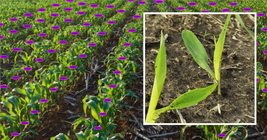
Stand Count
In agriculture, stand count refers to the assessment of the number of healthy and viable plants per unit area within a cultivated field. This crucial measurement is typically conducted shortly after planting and plays a pivotal role in crop management. Farmers aim to achieve an optimal stand count to maximize crop yields and resource efficiency.
Benefits
Higher Yields: Stand count helps maximize crop output by identifying and addressing areas with low plant density.
Efficient Resource Use: Accurate stand count enables farmers to allocate resources like water and fertilizer more effectively, reducing waste and environmental impact.
Better Management: Stand count guides informed decisions, allowing farmers to adjust practices and interventions for optimal crop growth throughout the season.
Weed Management
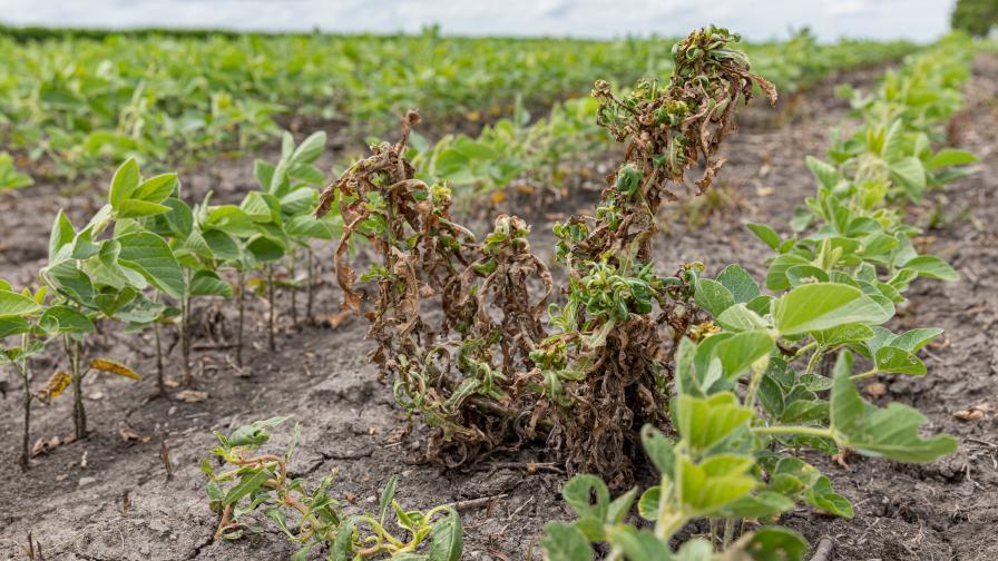
Weed detection is a critical aspect of modern agriculture, especially in high-value and multi-season crops like tomatoes, cabbage, potatoes, and spinach. These crops are economically significant and require meticulous weed management to optimize yields and maintain product quality.
Weeds can compete with these crops for essential resources such as nutrients, water, and sunlight, leading to reduced productivity and increased production costs.
Identification & Application
Using drones for weed analysis in high-value crops has significantly impacted agriculture. Drones equipped with advanced imaging technology, such as multispectral and thermal cameras, offer a birds-eye view of the fields, enabling rapid and precise detection of weeds.
Benefits
Enhanced Productivity: Efficient weed detection in high-value crops ensures optimal allocation of resources like nutrients and water, leading to increased productivity and higher yields.
Cost Reduction: By accurately identifying and managing weeds, farmers can minimize the need for costly herbicides and manual labor, reducing production costs and improving overall profitability.
Improved Crop Quality: Meticulous weed management facilitated by effective detection methods helps maintain the quality of high-value crops such as tomatoes, cabbage, potatoes, and spinach, ensuring better market value and consumer satisfaction.
Water Logging
Drones are invaluable tools for addressing waterlogging in agriculture. They provide early detection, precise monitoring, and data-driven decision-making, all of which are essential for effective waterlogging management. By helping farmers manage waterlogged areas more efficiently, drones contribute to improved crop health, increased yields, reduced costs, and more sustainable agricultural practices.
Surface & Elevation
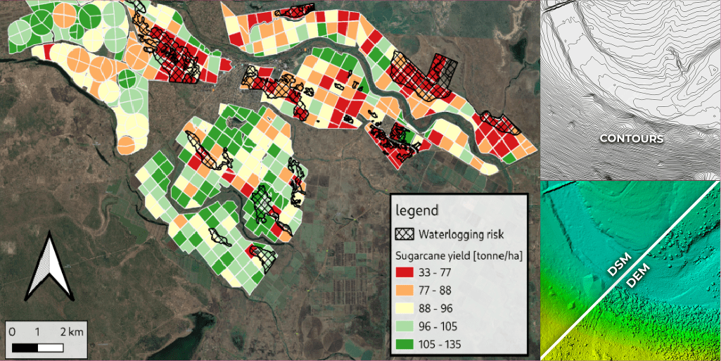
A high-precision Digital Elevation Map (DEM) is a useful asset for drainage modelling, particularly for the strategic placement of contour ridges. A DEM provides detailed elevation and slope data, allowing farmers to accurately identify how water will flow across their fields.
This leads to a number of key advantages:
Optimal Placement
Water Conservation
Reduced Flooding Risk
Enhanced Crop Yield
Cost Savings
Optimize Drainage
Enhance Soil
Conservation
Maximize Crop Productivity
Monitor Crop Health
Investing in a high-precision DEM for drainage modeling is a strategic decision that pays off through better water management, increased crop yield, and reduced operational costs
Contours
Contours maps as a derivative of DEM’s help with planning and easy interpretation.
Benefits
Early Detection: Drones enable quick identification of waterlogged areas in fields, allowing farmers to take timely action to prevent crop damage.
Precise Monitoring: With drones, farmers can closely monitor waterlogging patterns, helping them make informed decisions about drainage and irrigation strategies to mitigate the problem effectively.
Enhanced Crop Health and Yields: By efficiently managing waterlogged areas, drones contribute to improved crop health and increased yields, leading to reduced costs and more sustainable agricultural practices overall.
Digital Twins
Digital twins provide a powerful tool for precision, enabling farmers to proactively manage and mitigate waterlogging issues.
By combining real-time data, predictive modelling, and remote control, digital twins optimize water management, increase crop productivity, and promote sustainability within the agricultural sector all from the comfort of your kitchen/war room.