Introduction of Drones in Agriculture
I had the privilege of attending a recent showcase that delved into the transformative potential of drones in agriculture, and as representatives of A2D, we were eager to uncover the insights it had to offer. The event shed light on several crucial use cases that deserve our attention.
In the realm of agriculture, staying on top of the game is essential for both farmers and insurance companies. Constant monitoring of crop growth and implementing strategies to enhance overall production yields are paramount.
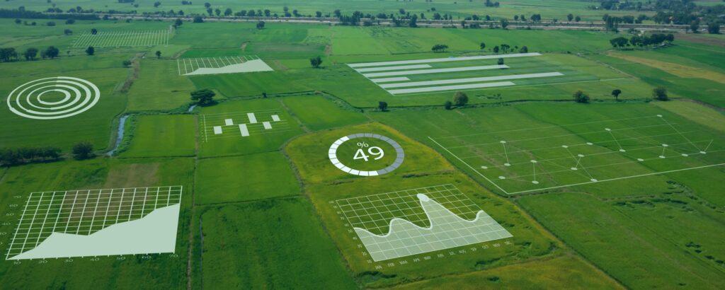
During the showcase, the speakers highlighted a range of key use cases that promise to revolutionize farming practices. These include farm mapping, the creation of digital elevation maps (commonly known as DEMs), precise stand counting, sophisticated weed analysis, and the assessment of water stress levels in crops. These applications demonstrate the immense potential of drone technology in bolstering agricultural efficiency and sustainability.
Farm Maps
Farm maps play an indispensable role in elucidating the fundamental aspects of agricultural land management. They serve as a visual aid, facilitating a range of essential tasks, including strategic land utilization, optimal crop planting and harvesting techniques, and efficient resource allocation. The significance of these maps transcends mere visuals, as they become instrumental in the conservation of soil quality, fertilizer application, targeted pesticide usage, and the effective management of water and irrigation systems.
At the heart of the utility of farm maps lies the dual objective of risk reduction and resource optimization. These maps empower farmers to make informed decisions that not only mitigate potential risks but also enable the allocation of resources to their most effective use. In doing so, farmers harness this invaluable tool to enhance their overall efficiency and, ultimately, their financial savings. Farm maps, therefore, stand as a pivotal asset in the modern agricultural landscape, offering a pathway to more sustainable and economically viable farming practices.
Digital Elevation Maps (DEM's)
The integration of cutting-edge technologies such as very high-precision Digital Elevation Models (DEMs) has ignited a transformative wave in contemporary agriculture, providing a multifaceted toolkit for farmers to enhance their practices and decision-making processes. In addition to their applications in risk reduction, strategic planning, and cost savings, DEMs join forces with other crucial components to usher in a new era of agricultural efficiency.
DEMs’ versatility shines as they seamlessly integrate with a spectrum of agricultural technologies, allowing farmers to tailor bespoke solutions to their precise needs. This adaptability extends to various critical domains, including:
- Soil Health Monitoring (Combined with EC Maps): DEMs, when combined with soil conductivity (EC) maps, offer deep insights into soil health, aiding farmers in optimizing soil management practices.
- Salinity Assessment & Irrigation Scheduling: DEMs play a pivotal role in assessing soil salinity levels, guiding informed irrigation scheduling to prevent salt buildup and maximize crop health.
- Crop Health Monitoring (Early Stress Detection & Disease Management): With the aid of DEMs, farmers can employ advanced crop health monitoring systems, detecting early signs of stress and promptly managing diseases, thus safeguarding their yields.
- Resource Allocation & Data-Driven Decisions: The integration of DEMs and associated technologies facilitates meticulous record-keeping and predictive analysis. This enables resource allocation based on data-driven insights, optimizing resource utilization and enhancing overall farm efficiency.
Moreover, DEMs continue to revolutionize irrigation practices by providing farmers with a comprehensive understanding of topography, enabling precise placement and management of water resources. This not only ensures optimal water utilization but also translates into substantial cost savings.
Furthermore, automation takes centre stage, ushering in unparalleled efficiency gains. Beyond mere monitoring, it empowers farmers to record risk factors, thus allowing for highly targeted interventions. This laser-like focus on potential problem areas enhances crop health and overall productivity.
Height information gleaned from DEMs remains indispensable, shedding light on potential water flow patterns and flood risk zones. Complementary tools like contour mapping and water flow redirection yield significant benefits. These measures contribute to water conservation, mitigate flood risks, and ultimately boost crop yields. When coupled with detailed soil maps and precise water redistribution, DEMs stand as invaluable assets, steering modern agriculture towards sustainability and profitability, while ensuring farmers are equipped with a comprehensive suite of data-driven tools.
Stand Count
The significance of stand count in modern agriculture became abundantly clear. This technology holds a wealth of advantages for both farmers and insurers alike.
For farmers, stand count serves as a linchpin in supply chain management. It empowers them to navigate inventory, adapt based on projected yields, and optimize resource allocation. Understanding stand count also unveils critical insights into yield predictions, offering a glimpse into the potential harvest. This information is invaluable in maintaining crop health by enabling early pest detection and instrument malfunction identification.
The use of drones for stand count emerges as a game-changer, dramatically reducing labour costs while enhancing overall farm productivity.
On the flip side, insurers reap substantial benefits from stand count data. It equips them with the tools needed for more precise risk assessment, allowing for premium pricing based on accurate information. Moreover, it acts as a safeguard against fraud and minimizes the need for extensive investigations, streamlining operational efficiency. In essence, the event shed light on how stand count technology not only bolsters agricultural practices but also revolutionizes the insurance industry’s approach, underlining the transformative potential of this innovation.
Weed Management
Weed analysis takes centre stage in the world of high-value, seasonal crops and its significance cannot be overstated. First and foremost, these crops represent the crown jewels of agriculture, and competition for vital resources such as water, nutrients, and sunlight are an ever-present challenge. Weeds, in their relentless pursuit of these essentials, pose a significant threat to crop health and yield. Moreover, these crops can inadvertently serve as unwitting hosts to pests and diseases, which have the potential to infiltrate and compromise the quality, flavour, texture, and appearance of the harvest. This contamination risk underscores the urgency of meticulous weed management.
Beyond quality concerns, weed analysis also intersects with the efficiency of the harvest, a linchpin of agricultural success. Weeds not only complicate the harvesting process but cast a looming shadow over the overall health of the soil, necessitating vigilant control measures.
Turning our attention to the game-changing benefits of drone-based weed management, we uncover a realm of possibilities:
- Spotting Weeds: Drones excel at swiftly identifying and pinpointing weeds across expansive fields. This capability enables precise, targeted treatment strategies, reducing the need for indiscriminate herbicide application.
- Optimizing Labor: Automation through drones streamlines the labour-intensive task of weed management, liberating human resources for more strategic and value-added activities.
- Data-Driven Decision-Making: Drones provide real-time data on weed distribution and density, ushering in an era of data-driven decision-making. This analytical approach empowers farmers to make well-informed choices, with far-reaching implications for crop health and overall outcomes.
- Resource Efficiency: Effective weed management translates into resource savings, encompassing water, fertilizer, and herbicides. These savings, in turn, pave the way for higher yields and enhanced crop quality, aligning perfectly with the goals of high-level, multi-seasonal crop production.
In essence, the fusion of technology and agriculture, exemplified by drone-assisted weed analysis, not only mitigates the persistent threats posed by weeds but elevates the standards of quality and productivity. It’s a testament to the innovative strides being made in modern agriculture, with drones taking flight as invaluable tools for securing the future of high-value crop cultivation.
Water Stress
A noteworthy stride in recent years has been the evolution of cost-effective sensors in thermal cameras. This technological leap has ushered in a realm of possibilities, with high-resolution thermal imagery emerging as a formidable tool on its own or when integrated with other mapping technologies. The synergy of these components unveils capabilities that surpass the sum of their individual strengths.
Key domains benefiting from this innovation include soil health monitoring, which, when combined with EC maps, offers invaluable insights. Salinity assessment and precision irrigation scheduling become more accessible, simplifying the task of monitoring crop health. The early detection of stress and the management of diseases become more effective with these thermal tools.
Furthermore, the ability to allocate resources judiciously is enhanced, guided by data-driven decisions rooted in meticulous record-keeping and predictive analysis. This amalgamation of technology and agriculture marks a significant stride forward, opening avenues for proactive action where needed.